Topographic Measurement Revolution: Leica Geosystems’ AP20 AutoPole
AP20 AutoPole for Robotic Total Stations: Revolutionizing Measurement and Surveying
Technology is rapidly evolving in the fields of surveying and geomatics, and the AP20 AutoPole by Leica Geosystems is a fascinating example of this evolution. This intelligent innovation is revolutionizing how robotic total stations operate, significantly enhancing productivity and measurement accuracy in the field. In this article, we will explore the key features of the AP20 AutoPole and its impact on the surveying domain..
What Is the AP20 AutoPole?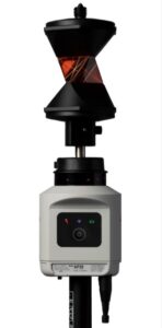
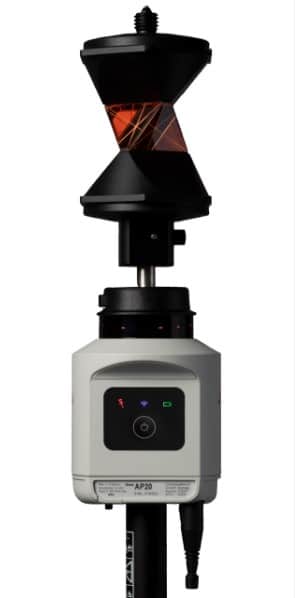
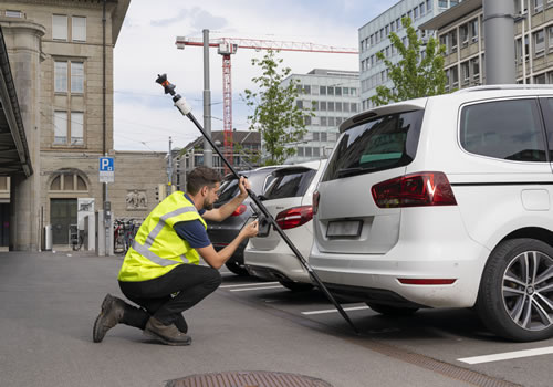
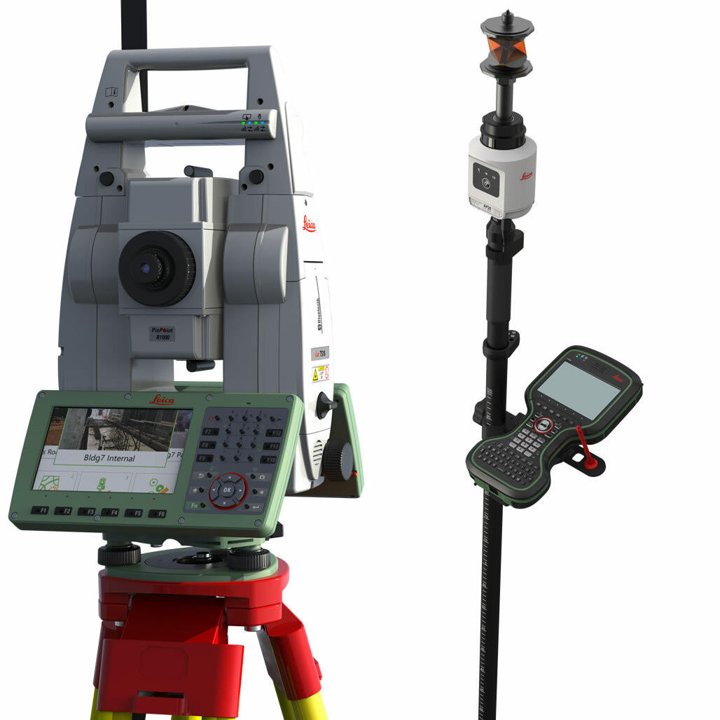
The AP20 AutoPole is a revolution in the field of intelligent pole accessories for Leica’s robotic total stations. This device enables quicker and more reliable setup, thereby enhancing construction and measurement operations. It stands out with its unique features, including target search and identification, automatic pole height readings, and pole tilt compensation.
The TargetID function ensures that your total station remains locked onto your target, ensuring unparalleled accuracy throughout your work. With the PoleHeight function, the pole’s height is automatically updated with each adjustment, eliminating errors related to pole height.
Furthermore, the tilt compensation provides exceptional flexibility when measuring or positioning points, without the need to level the pole. In summary, the AP20 AutoPole revolutionizes how you perform measurement tasks, offering increased efficiency and unmatched precision in the field.
Benefits of the AP20 AutoPole
The AP20 AutoPole offers numerous benefits to surveying and geomatics professionals:
Time Savings: Thanks to automatic pole height adjustment, the AP20 eliminates errors associated with manually entering pole heights in field software, saving valuable time in the field.
Increased Accuracy: The AP20 AutoPole ensures precise measurements through its inclination compensation, eliminating the need for bubble leveling.
Ease of Use: This intelligent system simplifies field measurements, allowing users to work faster and more efficiently.
Compatibility: It is compatible with robotic total stations and MultiStations from Leica Geosystems, making it a versatile solution for various applications.
Applications de l’AP20 AutoPole
Applications of the AP20 AutoPole
The AP20 AutoPole finds applications in various fields, including:
Surveying and Mapping: For collecting accurate field data for topographic mapping.
Construction: For monitoring construction progress and precise positioning of structural elements.
Environmental Management: For monitoring environmental changes and collecting data for natural resource management.
In conclusion, the AP20 AutoPole is a major technological innovation that simplifies and significantly enhances field measurement and surveying operations. With its ability to eliminate human errors and increase accuracy, it is an essential tool for surveying and geomatics professionals.